From Lapland to the Fjords
A 15 day self-supported trek from Swedish Lapland to the Norwegian Coast
- September 2019
- Trips // Bushwalking, Travelling
Share |


The time seemed right in 2019, I’d become comfortable with my off-track navigation, with walking in all seasons, and being self-reliant for longer trips all around Tasmania. Also I’d finally accumulated enough annual leave and there were cheap flights to Oslo!
I had 6 weeks in total. I had lots of ideas but no solid plans as I wanted to stay flexible with the weather and was very aware that it was September, well into the “shoulder” season and if winter made an early arrival that year I’d rather switch things up than stubbornly push on.
If everything went to plan, I’d aim to walk from Kvikkjokk in Swedish Lapland to the E6, the main highway connecting the North of Norway to the South. This plan would have me start out on the Kungsleden, a long hut based trail that in its entirety spans most the length of Sweden. After a few days on this trail I’d then turn left and head into the trackless Sarek National Park. I’d see the Rapa Valley, I’d pass between the highest mountains in Sweden, I’d pass into Padjelanata National Park, I’d pick up a trail for a few kilometers before heading cross-country once again, I’d spend days walking around huge lakes, I’d cross the border into Norway, I’d descend through Rago National Park, I’d pick up trails that lead to carparks, then roads that would lead to fjords and fjords that would put me at a bus stop by the E6.
I found a blog online that had done a similar route in the midst of summer, I found accounts of others doing sections of my proposed route so I concluded it should be possible just with a number of uncertainties for me. I was quite aware that I’d never been further than New Zealand previously and that this was by far my most ambitious undertaking. I didn’t know exactly how long it’d take but I did make sure I knew at what point I’d have to turn back if I was behind schedule and a number of other options to shorten the trip and get back to civilization from various if a river proved impassable or anything else unexpected was to occur.
The weather forecasts were looking as good as I could have hoped when I arrived in Oslo so I immediately booked flights to Kiruna, Northern Sweden for the very next day.
The next evening I walked right across Kiruna in the pouring rain to have my first experience with a non-english supermarket to tackle a 2 week lightweight shop. Google translate and meal creativity was key. The next day was a series of train and bus rides that eventually got me to Kvikkjokk at the end of the road with about an hour of daylight to spare. The last bus ride had consisted only of school children and fresh-looking hikers with large packs – none quite as unwieldly overweight as mine.
At this moment a horrible realization occurred to me – I’d left a big block of parmesan in the fridge of where I’d stayed in Kiruna! (I still don’t think I’ve forgiven my self for this!) I did consider getting a lift back to the nearest town to replace it but instead I had a quick look in the café come campers store in Kvikkjokk in hope but with no luck, it was too close to the end of the season and they’d mostly cleared the shelves. I’m not sure if it was to deal with the grief, as self-punishment or because I was worried I’d find an excuse to back out of the trip but I decided to forgo the civilized campsite and just start walking with less than an hour of daylight to go.
That night camped just off the track in the pines it dawned on me that this was my first time in the outdoors in the Northern Hemisphere, my first time being outside of Australia or New Zealand and here I was embarking alone on a two-week off-track idea that I’d dreamt up. I hadn’t even done so much as a day walk on this. Ambitious or naïve?
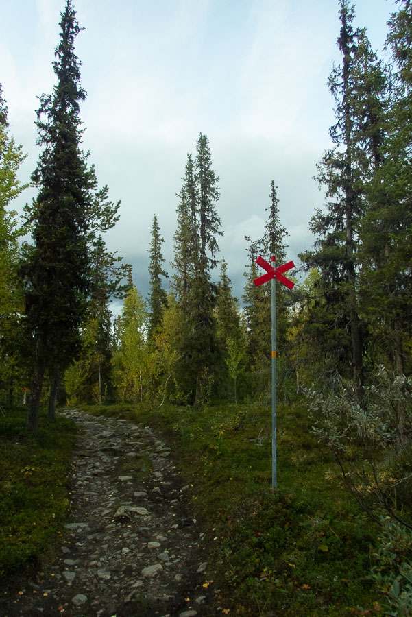
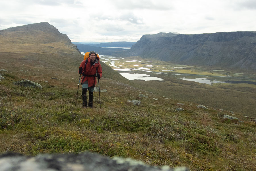
The first 2 days on the Kungsleden went well, my pack was absurdly heavy but I was finding the walking easy enough and covering decent distances. I was satisfied my pack would only get lighter and legs stronger from this point on.
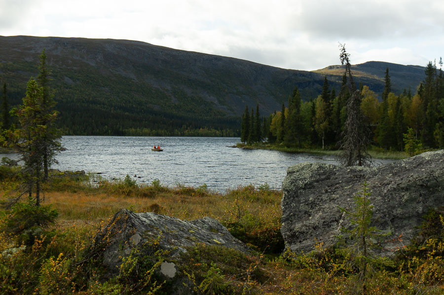
I passed a hut early on day 2 on my way down to the edge of a large lake where I was aiming to meet a ferry service whose timetable I’d systematically saved on my phone. I started talking to the sole occupant of the hut, a local walker that knew the area well. A seed of doubt was planted when he stated he thought the ferry service had finished for the season. Ah, that was something I hadn’t considered and would be a major hurdle. Thankfully the ferry arrived and the show went on.
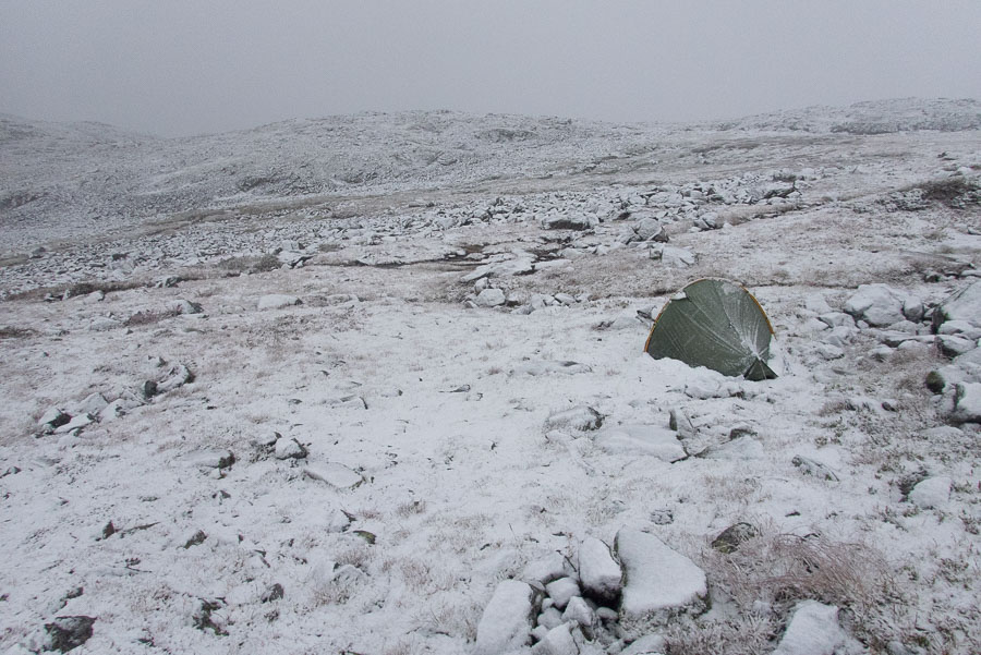
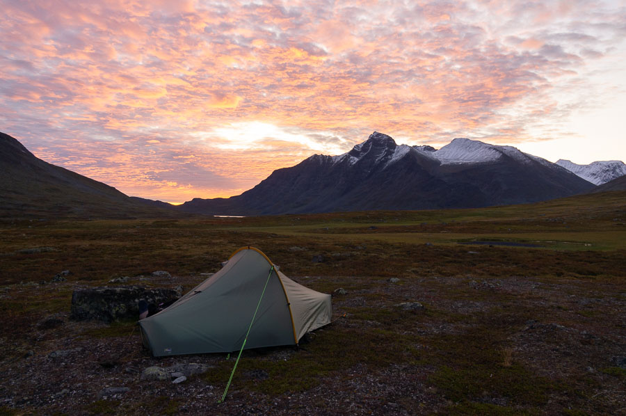
Later that day I turned off the Kungsleden and set my sights on Sarek and the Rapa Valley. A well worn pad existed for this section as it was a popular side track from the Kungsleden to see the famous viewpoint over the Rapa Valley. The weather deteriorated over the afternoon and I ended up setting up camp quite early as I figured there was no point pushing on with no view since I was coming into the section that I’d come all this way to see.
It was snowing and generally fowl beyond the vestibule by the time I cooked my spaghetti rations for dinner that night. Perhaps I won’t get to see the Rapa Valley after all.
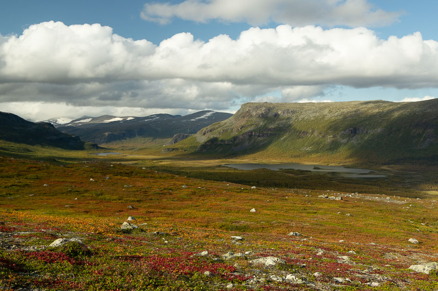
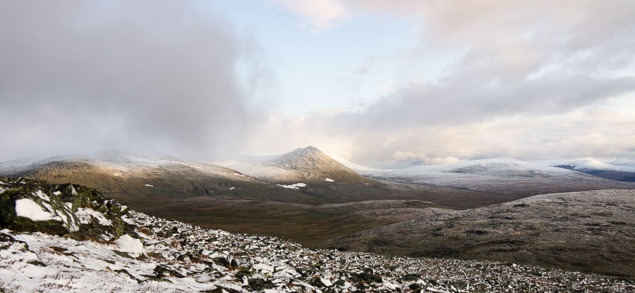
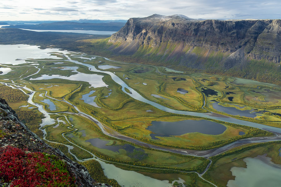
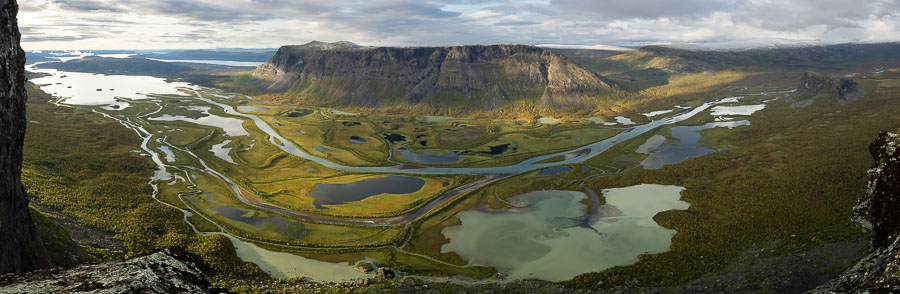
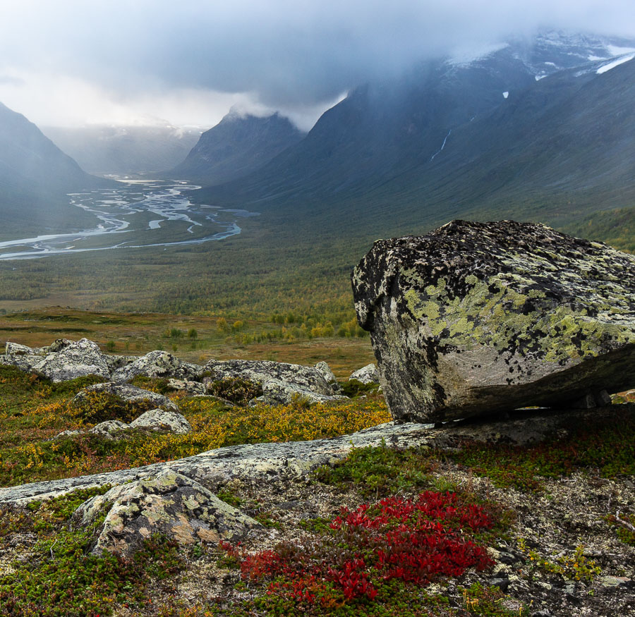
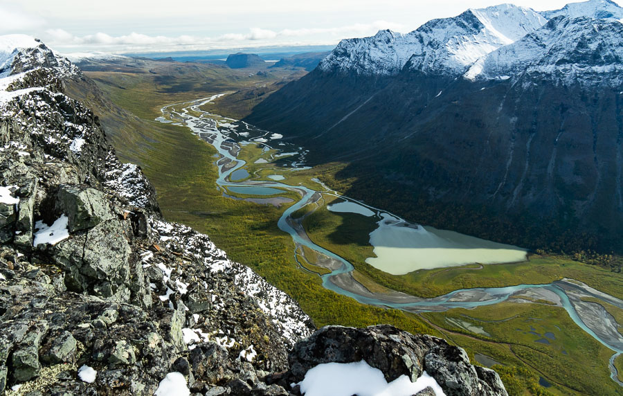
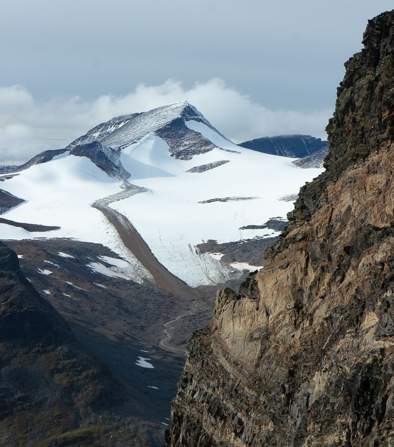
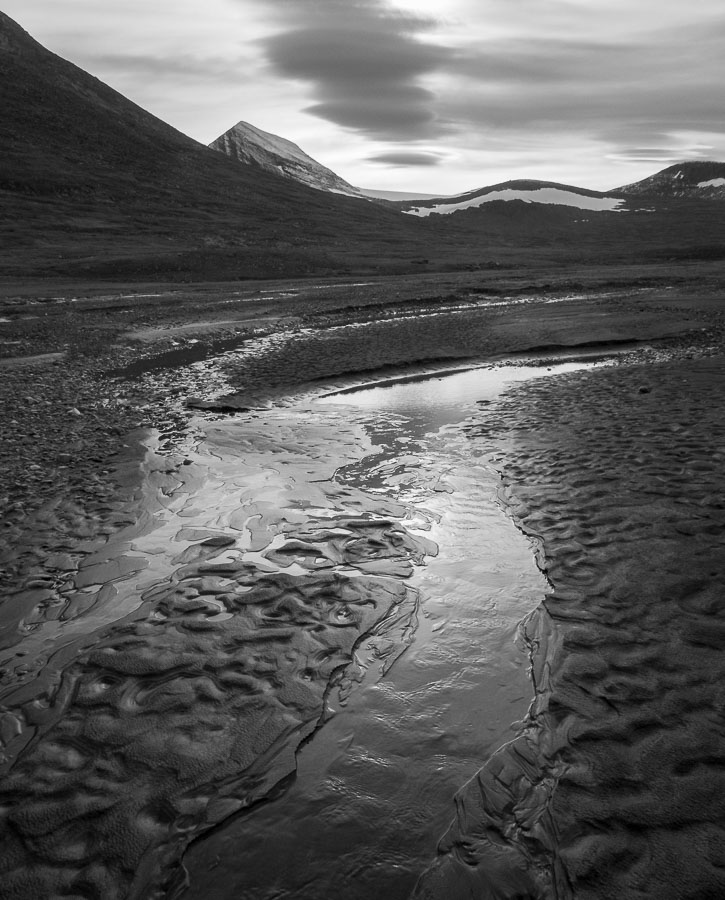
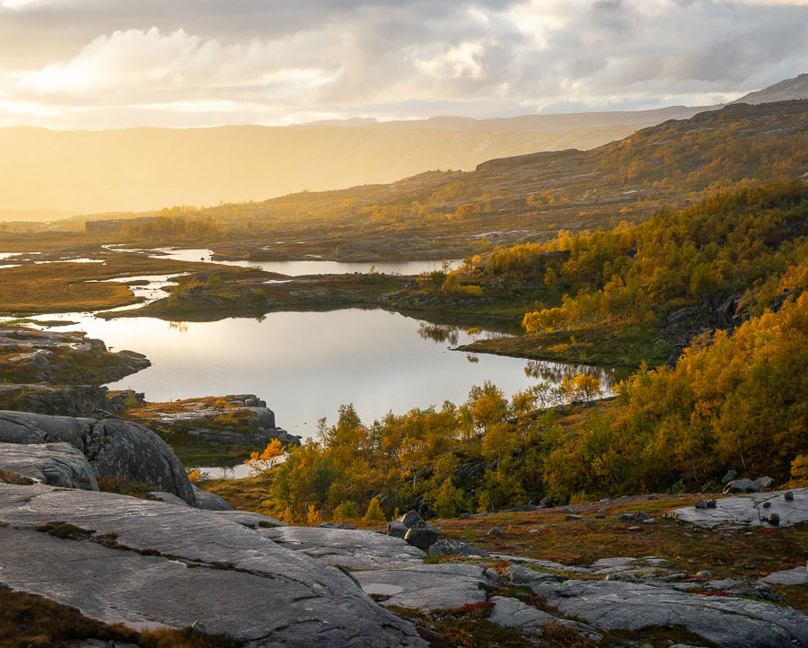
I woke early the next morning to a good dusting of snow all around but most importantly the cloud seemed to be beginning to disperse from around me. I left my tent and headed up the hill to the viewpoint. Autumn had taken hold of the deciduous foliage in the valley below, the clouds continued to disperse revealing the layer of fresh snow on all the high points and eventually the sun began to breakthrough lighting up the valley floor, a loose weave of glacial river strands and golden lines of birch trees. Sublime.
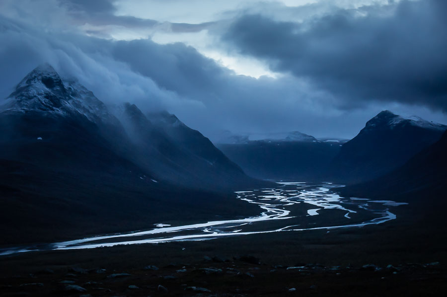
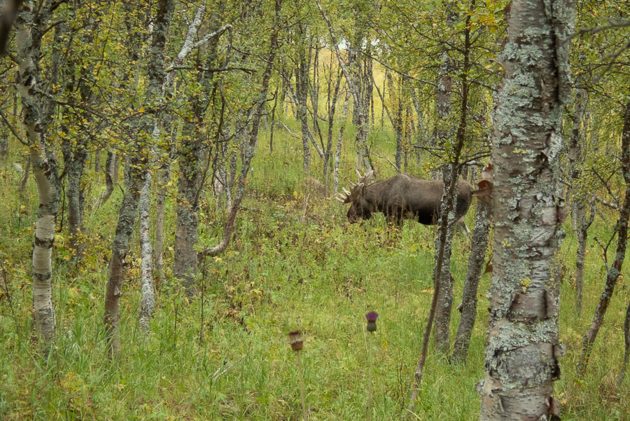
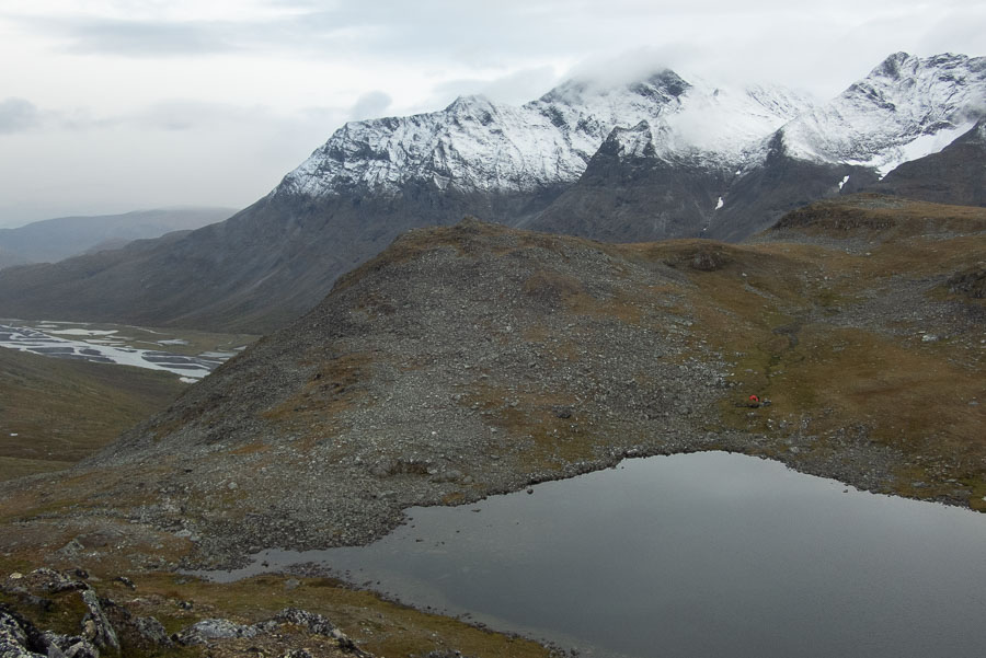
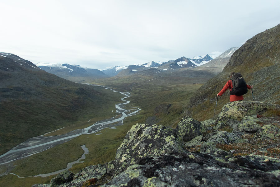
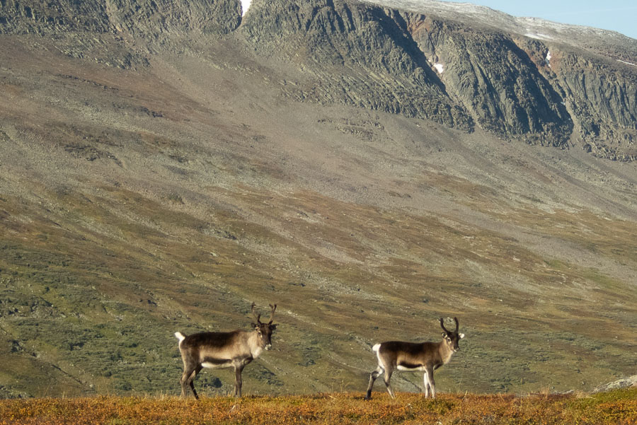
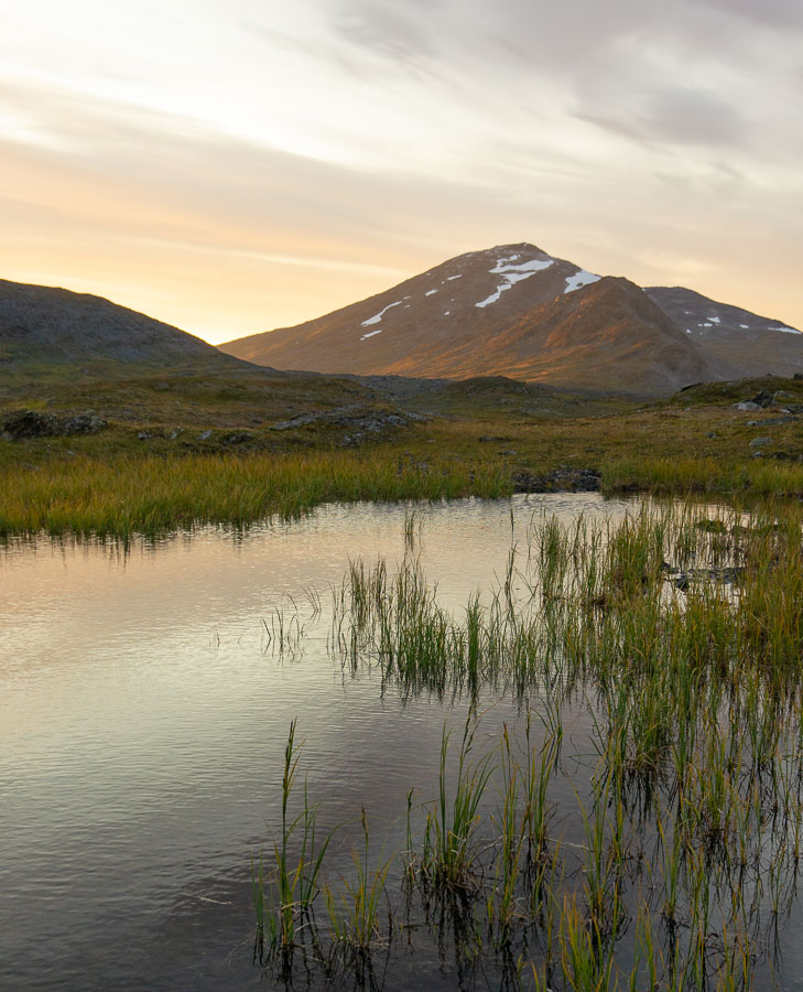
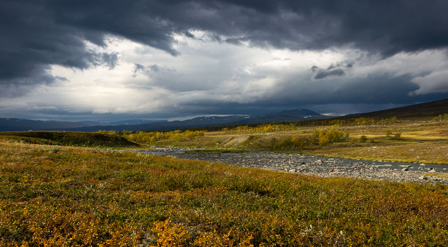
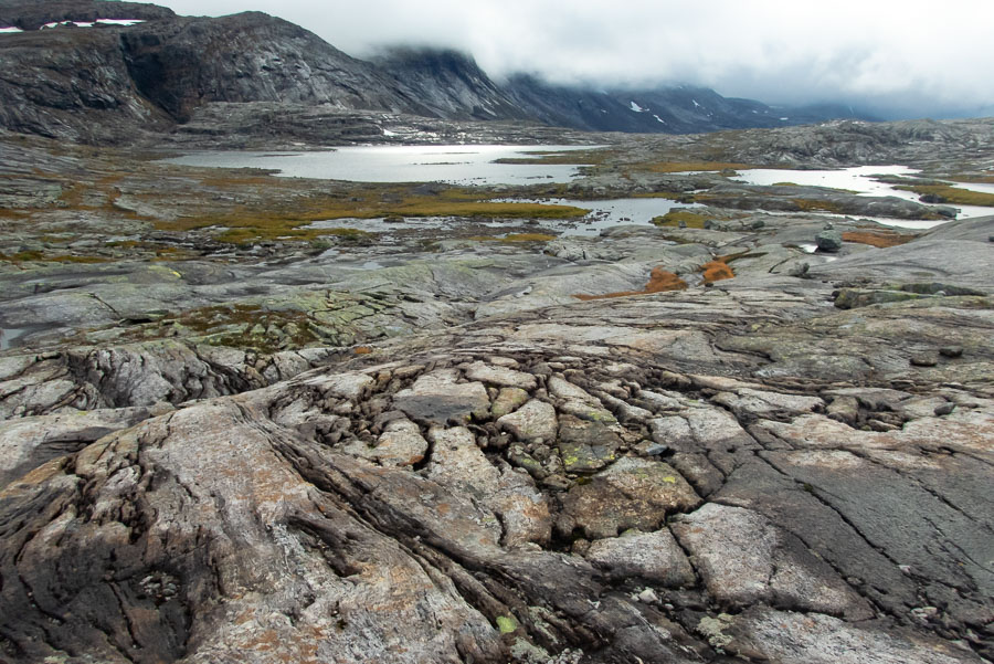
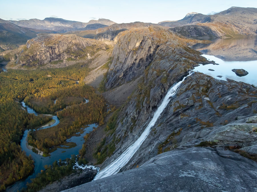
Over the coming days I’d walk through the heart of Sarek National Park, following the footprints of the moose and deer across the river silt, finding a new found love of the balance and patterns of braided rivers from the vantage points that the mountain passes provided. I climbed a peak and looked across to glaciers at eyelevel, I ate a lot of wild blueberries which were a welcome surprise that I hadn’t encountered before or anticipated. I saw a few other groups of people and signs of life but often they were on a parallel ridge or heading in a different direction so there were very few actual exchanges. Many of the popular passes and even some sections alongside rivers had developed a pad which did take away the feeling of total remoteness that I’d prepared for but I still certainly had a strong sense that I was well off the beaten path. The most overwhelming aspect was the vastness and the grandeur of the landscape. I’d never experienced such wide-open spaces, huge valleys and rows of distant peaks. It was on a scale so far removed from anything we have here in Tasmania and the proportions were all different from the high country of New Zealand.
My feet started giving me trouble and I was beginning to worry I’d run out of strapping tape if they continued to require this much attention to keep me moving. I stopped walking early in the afternoon one day because they were causing me that much pain. Thankfully they toughened soon after that and I didn’t have any more issues with them.
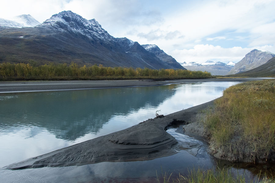
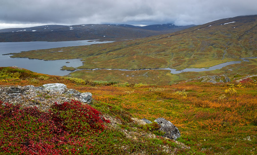
Over time the height of the mountains surrounding me reduced as I got to the other end of Sarek and the size of the lakes increased as I entered Padjelanta National Park. In hindsight I would have spent more time exploring Sarek as the mountainous landscape there is what truly captivated me however at the time, I wasn’t certain how long the rest of the trip would take and I was conscious of exactly how many serves of rice and oats I had left to get me there.
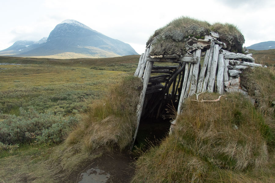
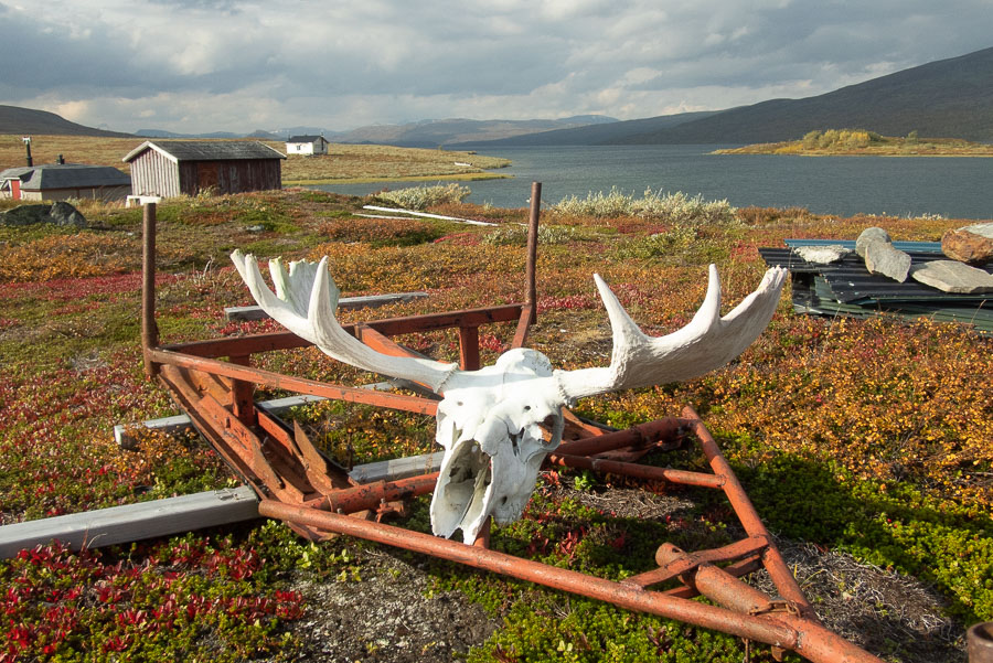
I saw no one as I picked up a track for a few kms into Padjelanata. I passed a couple small shack communities belonging to the Sami. They were completely abandoned in the shoulder season. Life would only return when the land and lakes had properly frozen allowing sled travel to open up the area for a winter of ice fishing.
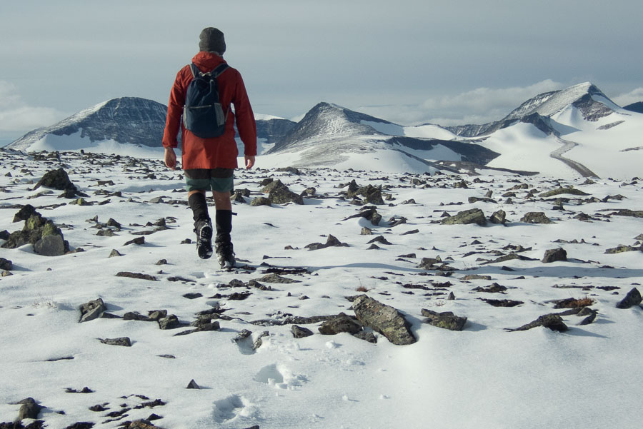
The going was slow once I left the track again and trudged through the marshy scrub alongside these large lakes. I traded the slow marshy lake edge for a higher ridge which was more enjoyable yet the biting wind and low cloud kept my navigation on its toes. There were a few days in this section where I’d only walk a few hours as the weather was quite fowl and I was comfortable that my overall progress was where it needed to be.
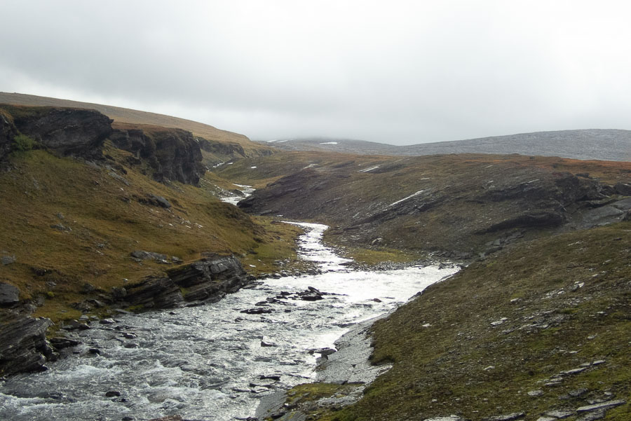
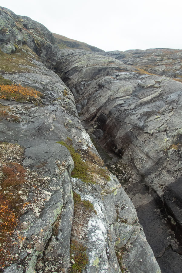
The terrain changed, the large lakes and low scrub was slowly replaced by granite as I neared the Norwegian border. I came across a series of these long shallow chasms in the granite. They slowed me down a lot and worried me about what was still to come. They were only about 4m wide and probably about the same depth so not enough of a feature to appear on maps, but they were too wide to jump and too overhung to downclimb with enough confidence that I could get back out. I’d end up having to follow the edge for a few hundred metres until I could find somewhere to cross only to come to the next one and have to repeat the process. I worried that in this new landscape of rolling granite slabs I was going to come up against something impassable that would turn me around so close to the end.
Thankfully that didn’t happen and I un-ceremonially crossed into Norway and Rago National Park. I came across a hut, a track and even another hiker. The first person I’d seen in a while. I opted to stick to the comforts of my tent that night, not feeling ready to socialise and let go of everything the trip had given me now that I was sensing I was getting to the end. I later regretted this when the wind picked up drastically in the middle of the night forcing me to relocate my tent.
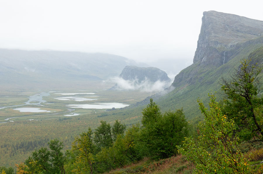
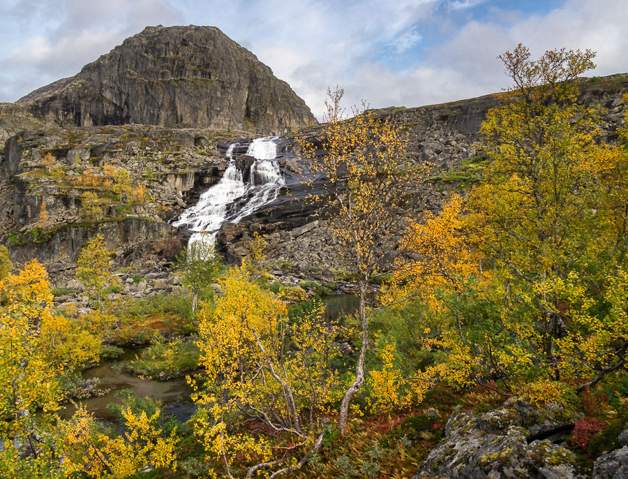
At this point getting to the road which signified the end was only a long day’s walk away but as I still had some food left, I didn’t feel any rush to let it end. I spent a couple of days exploring the backcountry of Rago, enjoying the autumn colours and the impressive geology.
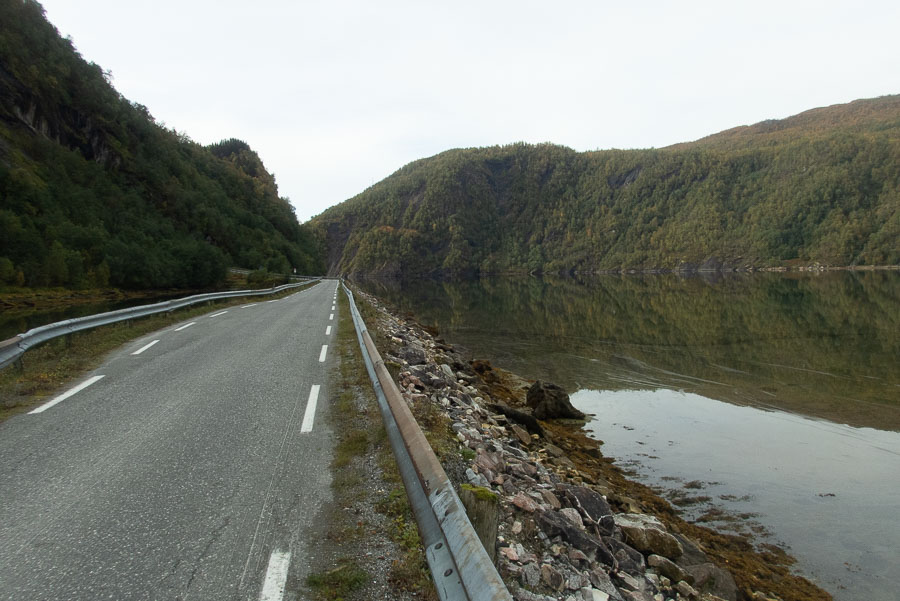
I couldn’t drag it out any longer without my mother starting to get worried so I descended to sea level, walked a few kms along a road, was amused that what my brain said should have been a lake was actual tidal, filled with salt water and lined with seaweed and shells, took a photo with the sign that read Nordfjord and hitched a ride to the nearest town.
To read commentary alongside the photos, click to open a photo in the fullscreen viewer and ensure captions are turned on.
Want to see more photos from Scandinavia? View the gallery